Architecting the Emergency
We are Selin Doğaner and Rami Msallam, architects, researchers and educators. We both work with mapping and spatial investigation, looking at how environmental and political conditions shape territories and the people living in them.
Selin Doğaner is an architect, researcher and educator based in Berlin. She studied at TU Wien, TU Munich, Cardiff University and the Berlin University of the Arts, and currently teaches at the University of Siegen. At UdK, she initiated and co-taught The City in Crisis: Phases of a Disaster with a fellow researcher, later developed into a jointly authored master’s thesis on reconstruction governance in Hatay, recognised by the Max Taut Prize. Her work moves between fieldwork, mapping and design, as well as teaching, writing, exhibitions and collective projects. It has been presented at ETH Zürich, Princeton University, Ca’Buccari in Venice and across Berlin.
Rami Msallam is an architect and spatial investigator based in Zurich. He trained at ETH Zürich and completed his master's at the Centre for Research Architecture, Goldsmiths, University of London, on the Forensic Architecture Scholarship, graduating with distinction. His research on environmental violence in (post-)conflict geographies, including wildfire, has been presented at the Cartographies of Loss conference at Carleton University and the Unmasking Space symposium in Venice (2025). He is currently a researcher at the Chair of Landscape Architecture and Geohistorical Practice (Prof. Aisling O'Carroll) and teaching assistant at the Chair of Architecture of Territory (Prof. Milica Topalovic) at ETH Zürich.
Together, we want to use architecture to understand and to design. We work through research, mapping, teaching, exhibitions, publications and visual media, through different kinds of information together and turning them into spatial questions and proposals.
Architects arrive at a disaster twice, before, planning for resilience, and after, rebuilding. During the disaster, they are absent, or, affected.
Two nights ago, Selin’s dad was evacuated from his home. He is an architect. He took his passport, his family moved to a nearby empty lot. The neighbouring town burnt down.
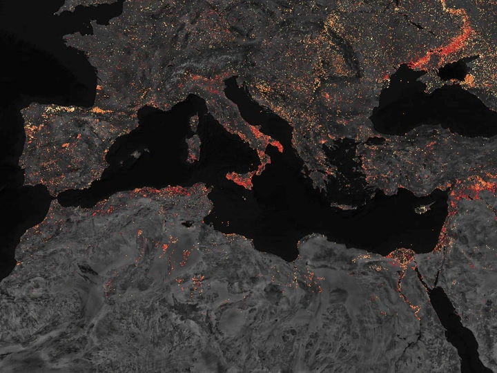
In 2025, the EU experienced its worst fire season on record. 7783 fires burnt 1.08 million hectares, almost the size of Cyprus. Between prevention and reconstruction is a gap in architectural agency, the during.
Though navigating disaster is spatial. These are the moments the built environment fails, and the affected are left to read and reorganise space on their own. Is the road an escape or a trap? Car parks, beaches, football pitches become shelters. Movement, access, what is defended and what is left to burn are spatial decisions. Architects are trained to think about them, but are not there.
We propose to look at the “during”. What we could do if we were, and what we need to learn to be useful. We bring methods from research into post-earthquake reconstruction and housing governance, and visual investigations of environmental violence in extractive and conflict zones. We work through mapping, layering imagery, environmental data, infrastructure, ownership, laws, institutions and people, to design the “during” with them.
“During” starts as a school. We investigate fire-prone territories with firefighters, ecologists, forest services, civil protection and people who lived through fire. We bring mapping, visual investigation and spatial design, they bring knowledge. Students use these different forms of knowledge to test what architecture can contribute.
With LINA, we want to test this method and build a network / curriculum for Architecting The Emergency. The school is part of the research. Instead of the two of us defining this new practice alone, many students can test and design it with us, producing possibilities we cannot predict alone.